Unmanned aircraft systems
We solve the most complex challenges in the field of unmanned aircraft systems with a relentless commitment to precision, autonomy, and cutting-edge technologies.
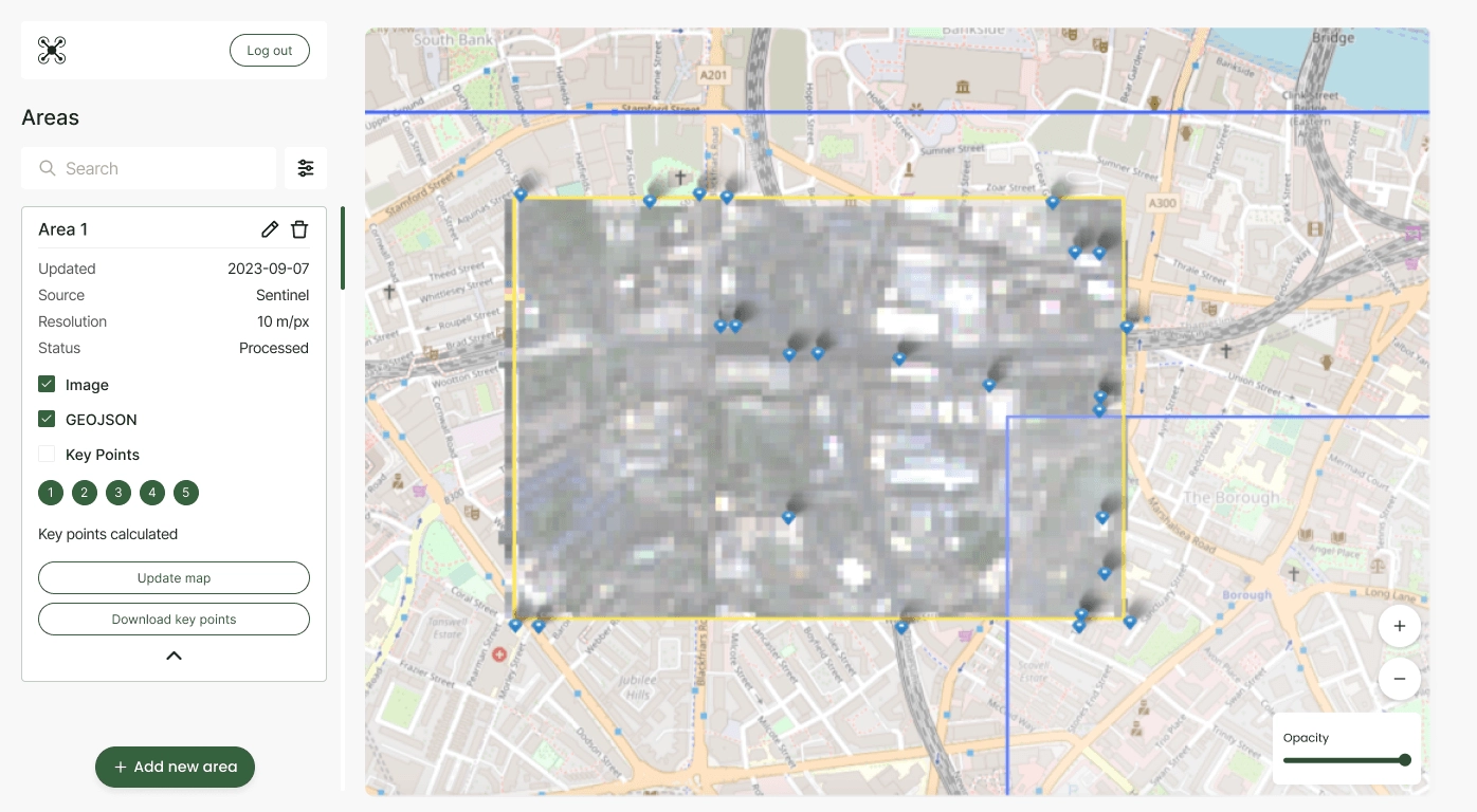
UAV Inertial Navigation Systems
Ensuring the success, safety, and reliability of your UAV missions, even in critical scenarios like disaster response, search and rescue operations, or GPS-denied environments.
Our Expertise


Features
Hovering and Position Stabilization
Autonomously evaluates and adjusts the drone's position for hovering in place without manual calibration.
Navigation Planning
Using the drone's internal sensors to map out a precise flight path to navigate UAV without depending solely on GPS.
We work with
Cameras/sensors
- IMU sensors
- Thermal cameras
- lidar sensors
- raspberry camera
- USB cameras
Control systems
- pixhawk
- dji
- Custom
Use cases
Precision
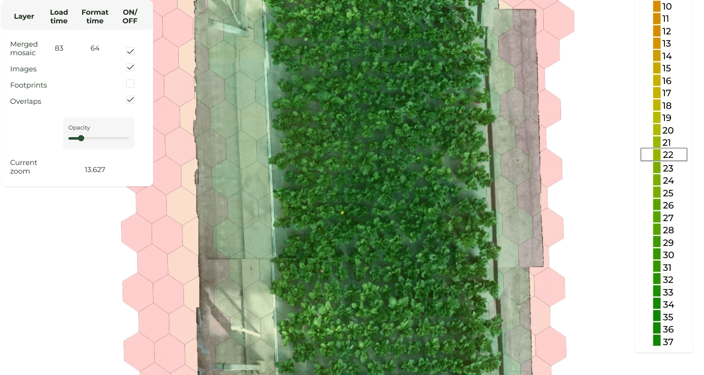
Agriculture
Meet drones that accurately survey crops, assess soil conditions, and optimize farming practices.
Geological
Exploration
Next-gen geological surveys and mineral exploration, especially in remote or challenging terrains.
Environmental
Monitoring
Accurate data collection and mapping for various ecological studies and conservation efforts.
Search and Rescue
Operations
Navigating complex and GPS-denied environments is invaluable in disaster-stricken areas.
Indoor/Outdoor
Inspections
Detailed inspections in various infrastructure facilities, meeting accuracy, safety, and efficiency standards.
Urban Air
Mobility
Avoid obstacles within dense urban areas to ensure safe and reliable cargo transportation.
UAV data analytics
Analyzing comprehensive drone data to extract meaningful insights and facilitate informed decision-making based on an in-depth understanding of the collected information.
Our Expertise

Use cases
Photography/
Videography
Steady and smooth shots for stunning aerial footage for films, commercials, and real estate marketing.Wildlife
Conservation
Objective identification helps track wildlife, aiding in the protection of endangered species.Emergency
Response
Locating survivors or assessing damage to enable more efficient search and rescue operations.
Harness innovations toempower your uav
Simulator for Training and Test Flights


Safe & cost-efficient practice
A safe environment for repetitive training of specific maneuvers without the risk of damaging your physical devices.
Advanced customization
Replicate real-world conditions, from different terrains to adverse weather, for comprehensive UAV training.
Time-saving automation
Training sessions can be automated and conducted anytime, providing data for analysis and improvement.
Case studies
Talk to our experts
Let’s discuss how Quantum can enhance your geoanalytics with AI and machine learning